Table Of Contents

Latest update [menu]
* Optimizations for Android 10 and up.
Description [menu]
DS Altimeter is an elevation meter, elevation logger, and altitude mapper. In addition to showing and optionally tracking your altitude, the app allows you to search the altitude for other locations as well.
You can select from the best sources of elevation data, including:
1. Location based altitude from NASA's Shuttle Radar Topography Mission.
2. Satellite based altitude (GPS altitude) corrected to height above mean sea level (AMSL).
3. Get actual land survey altitude values for your location from the United States Geologic Survey - available for customers in the contiguous United States, southern Canada and Mexico.
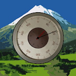
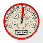
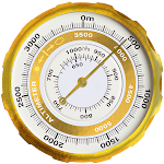
4. Devices equipped with a barometer sensor can also obtain pressure altitude which is converted to elevation above sea level. For the most precise readings, calibrate the pressure altitude.
The barometric altimeter offers 4 calibration tools:
1. Calibrate to the nearest airport. Choose your airport from the app's dynamic list of nearest airfields. Airfield data is usually updated every 20 - 30 minutes.
2. Enter a QNH value.
3. Enter the benchmark (known) altitude value for your location.
4. Calibrate the barometric altimeter against the SRTM altitude map.
DS Altimeter also works offline: barometric altitude and GPS altitude corrected to elevation above sea level do not require an internet connection.
NEW IN DS ALTIMETER:
● Photo altimeter. Snap a picture of your favorite high places with the altitude shown on your photograph.
● Easily get the altitude difference and grade between two locations by tapping 2 points on a map.
● Record altitude profiles and elevation tracks for your favorite journeys to the highlands, the lowlands and everything in-between!
● [SPECIAL] View your altitude recordings on the included maps with all track points displayed. Tap any track point and get the altitude at that point.
● Elevation Search: Enter a place name or address and get the altitude above sea level at that location.
Upgrade the application to pro and gain access to even more features including the Altimeter Widget.
Going skiing? Record your ski run with DS Altimeter, then view your ski trail with its elevation points on the included maps. Mininum and maximum altitude points for your run will be clearly shown.
Altitude mapping and bathymetry (lake and sea depths) are also included with DS Altimeter. Tap anywhere on a map to find altitude or water depth at that location.
● The application includes a detailed help section.
* The perfect altimeter for skiing, hiking, mountain climbing and other outdoor sports, boating, marine navigation and anytime you are curious about your elevation!
PERMISSIONS AND PRIVACY:
DS Software does not collect any personal information such as phone ID or user account information.
1. Location permission if required for GPS. GPS data is used for land survey altitude matching and to determine elevation above the Geoid (then corrected to elevation above sea level).
2. Photos/Media/Files permission is required for the screen capture procedure allowing you to share an image of your altitude result.
3. Wake-up phone (Wake-Lock) and Boot Permission are required to periodically refresh the values on the Altimeter Widget and to reactivate the Altimeter Widget when the phone is rebooted / restarted.
4. Internet and Network permissions are needed to access online land survey databases in Government facilities.
5. Billing permission is required to purchase the application for the purpose of activating the altimeter widget, remove advertising and to receive unlimited altitude-track recordings.
6. Vibrate permission - to vibrate the phone for important alerts.
How to install Altimeter & Altitude Widget APK for Android [menu]
Download Altimeter & Altitude Widget APK file (com.discipleskies.android.altimeter_15462_11195347.apk) from SameAPK.com, then follow these steps:
Update Phone Settings
- Go to your phone Settings page
- Tap Security or Applications (varies with device)
- Check the Unknown Sources box
- Confirm with OK
Go to Downloads
- Open Downloads on your device by going to My Files or Files
- Tap the APK file you downloaded (com.discipleskies.android.altimeter_15462_11195347.apk)
- Tap Install when prompted, the APK file you downloaded will be installed on your device.
How to install Altimeter & Altitude Widget APK on Windows 7/8/10 or MAC PC? [menu]
Download Altimeter & Altitude Widget APK file(com.discipleskies.android.altimeter_15462_11195347.apk) from SameAPK.com to your PC (ex: /Users/xxx/Downloads/(com.discipleskies.android.altimeter_15462_11195347.apk)), then follow these steps:
Using Emulator:
- Download And Install one Emulator Softwares (Ex: Bluestacks, GenyMotion, NoxPlayer)
- Simple install APK on PC by drag and drop file com.discipleskies.android.altimeter_15462_11195347.apk on Emulator screen
Altimeter & Altitude Widget APK Pros & Cons [menu]
Pros
- This app is safe, it's not require high risk permissions
- Compatible with 32 bit device (most Emulator using 32bit arch CPU)
- Compatible with 64-bit device (some android device and current Bluestacks)
Cons
Everything is good.