Table Of Contents

Latest update [menu]
Version 1.8 updated.
Description [menu]
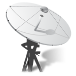
Finding a TV satellite or an antenna in azimuth can be pretty difficult. Before you can find it with a compass you have to do some calculations using GPS location, magnetic variation, compass azimuth and satellite azimuth. Sat Finder (Satellite Finder) is a tool which will help you to set up satellite dish. Satellite finder provides LNB tilt and specifies azimuth elevation according to your location relates to GPS and it will choose satellite.
Satellite director & sat finder app will give you accurate azimuth elevation. User can select satellite from list to set the dish antenna direction. User can see satellite data like longitude and latitude and show your position on google map.
Bubble Level
A spirit level is an instrument designed to indicate whether a surface is horizontal (level) or vertical (plumb). Different types of spirit levels may be used by carpenters, stonemasons, bricklayers, other building trade’s workers, surveyors, millwrights and other metalworkers, and in some photographic or video graphic work
Clinometer
An inclinometer or clinometer is an instrument used for measuring angles of slope (or tilt), elevation, or depression of an object with respect to gravity's direction. Clinometers measure both inclines (positive slopes, as seen by an observer looking upwards) and declines (negative slopes, as seen by an observer looking downward) using three different units of measure: degrees, percent, and topo (see Grade (slope) for details). Astrolabes are inclinometers that were used for navigation and locating astronomical objects from ancient times to the Renaissance.
Geo Area & Distance Calculator
The Geo measure area calculator is an excellent GPS field area map measurement tool as an app. It helps you greatly in measuring anywhere, while you are traveling someplace if you want to calculate the distance between two points and cities. It is a bright GPS and land surveying app. It is used to farm and google mapping measure distance in fast. Even, it assistance you well to check area converter, their units and conversion in easy. It will also calculate the distance between two locations.
How to use this app:
1. Enable your internet and location on your device.
2 Select your desired satellite.
3 Calibrate your dish antenna to the perfect point accordingly.
How to install SatFinder & Satellite Director APK for Android [menu]
Download SatFinder & Satellite Director APK file (com.aspirationstudio.satfinder.gyrocompass_9_8542454.zip) from SameAPK.com, then follow these steps:
Update Phone Settings
- Go to your phone Settings page
- Tap Security or Applications (varies with device)
- Check the Unknown Sources box
- Confirm with OK
Go to Downloads
- Open Downloads on your device by going to My Files or Files
- Download Split APKs Installer (SAI)
- Download and unzip file you already downloaded (com.aspirationstudio.satfinder.gyrocompass_9_8542454.zip)
- Open Split APKs Installer and follow steps on this app.
- Tap Install when prompted, the APK file you downloaded will be installed on your device.
How to install SatFinder & Satellite Director APK on Windows 7/8/10 or MAC PC? [menu]
Download SatFinder & Satellite Director APK file(com.aspirationstudio.satfinder.gyrocompass_9_8542454.zip) from SameAPK.com to your PC (ex: /Users/xxx/Downloads/(com.aspirationstudio.satfinder.gyrocompass_9_8542454.zip)), then follow these steps:
Using Emulator:
- Download And Install one Emulator Softwares (Ex: Bluestacks, GenyMotion, NoxPlayer)
- Download and unzip file com.aspirationstudio.satfinder.gyrocompass_9_8542454.zip.
- Using ADB or Split APKs Installer same as install for Android.
SatFinder & Satellite Director APK Pros & Cons [menu]
Pros
- This app is safe, it's not require high risk permissions
- Compatible with 64-bit device (some android device and current Bluestacks)
Cons
- No best performance On PC (Windows, MAC) (because it's not exists X86 variant)