Table Of Contents

Latest update [menu]
Correction in Z Coordinate in DXF export.
Description [menu]
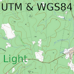
The Topography APP is an excellent application for georeferencing or land surveying, design of electrical networks, avenues, streets, subdivisions and studies in general.
Export your surveys to DXF (Autocad), KML (Google Earth), CSV (MS Excel) without the slightest difficulty and the possibility of transmission by email of their withdrawals directly from the field to the office.
In the Professional version you can mark up to 5000 points for surveys.
How to install Topography APP APK for Android [menu]
Download Topography APP APK file (aguiar.com.br.point_gps_59_51478698.apk) from SameAPK.com, then follow these steps:
Update Phone Settings
- Go to your phone Settings page
- Tap Security or Applications (varies with device)
- Check the Unknown Sources box
- Confirm with OK
Go to Downloads
- Open Downloads on your device by going to My Files or Files
- Tap the APK file you downloaded (aguiar.com.br.point_gps_59_51478698.apk)
- Tap Install when prompted, the APK file you downloaded will be installed on your device.
How to install Topography APP APK on Windows 7/8/10 or MAC PC? [menu]
Download Topography APP APK file(aguiar.com.br.point_gps_59_51478698.apk) from SameAPK.com to your PC (ex: /Users/xxx/Downloads/(aguiar.com.br.point_gps_59_51478698.apk)), then follow these steps:
Using Emulator:
- Download And Install one Emulator Softwares (Ex: Bluestacks, GenyMotion, NoxPlayer)
- Simple install APK on PC by drag and drop file aguiar.com.br.point_gps_59_51478698.apk on Emulator screen
Topography APP APK Pros & Cons [menu]
Pros
- This app is safe, it's not require high risk permissions
- Compatible with 64-bit device (some android device and current Bluestacks)
Cons
- No best performance On PC (Windows, MAC) (because it's not exists X86 variant)